Part 1 of personal reflections and historic explorations of the Grafton to Cairo length of Illinois Route 3 by writer and poet Richard Stimac.
When I was young, my parents would take me to the 8,000-plus acres of Pere Marquette State Park, just north of Alton, Illinois. We’d drive up Illinois Route 3 from where we lived in Granite City, past Wood River where Lewis and Clark made their first winter camp, then Alton, where Lincoln and Douglass debated the question of slavery, all the way to Grafton, then to where the Illinois River dumps into the Mississippi. From Alton northward, the Great River Road, as Illinois Route 3 is known, sneaks between the river and 150-foot limestone bluffs gouged when the Midwest flooded with glacial melt ten-thousand years ago.
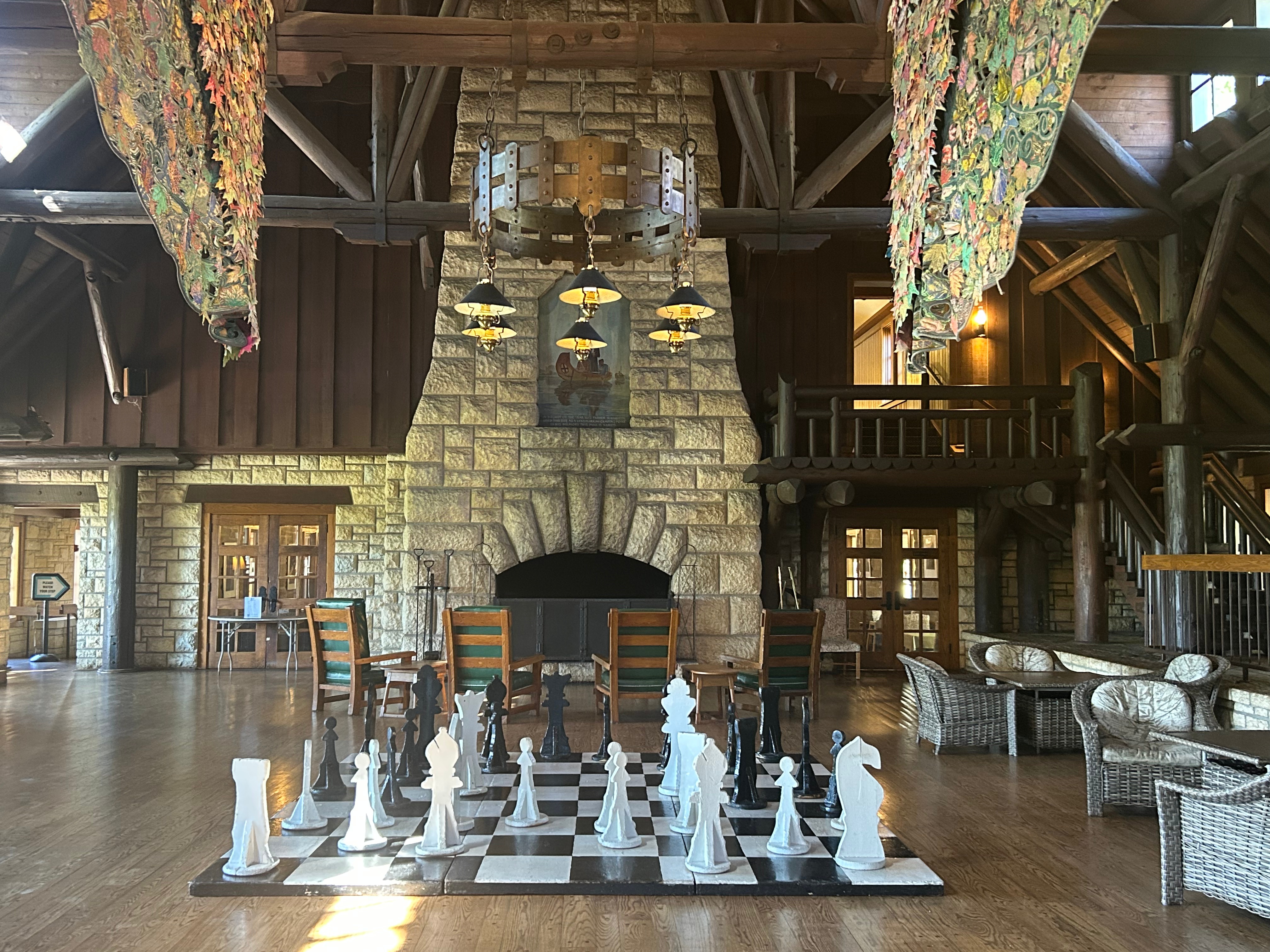
The New Deal’s Civilian Conservation Corps constructed the Pere Marquette hotel-restaurant, cabins, and trail amenities with large, exposed ceiling timbers, a massive limestone fireplace, unpolished flagstone floors, and walls of windows that inundate interior spaces with light. All examples of rustic architecture popular at the time. Kaskaskia villages hosted the park’s namesake Jacque Marquette and voyageur Louis Jolliet during the two French men’s return up the Illinois River.

Image: Richard Stimac
They were searching for a route to the Pacific Ocean. On learning that the Mississippi River flowed south, their Quebecois crew paddled them up the Illinois River to the Great Lakes. A massive stone cross marks their landing spot on the grounds of the state park. Neither the Kaskaskia nor the French people remain. Their names do.
MOSES, BRAUNSCHWEIGER AND KOOL-AID
A distinct image from a family weekend to the park hold firms in my mind. On one hike, we climbed a steep path to an outcrop with a small stone pavilion that overlooked the Illinois River and the bottomland to the west. For some reason, I imagined myself as Moses marching his people through the desert, even though I was climbing a dirt path through dense deciduous forest of the humid continental climate in the American Midwest. Like all prophets, I simply made up a story to get through the “march or die” task my parents burdened me with. I distinctly remember looking up the trail to a break in the tree line. The sun formed an aura around the wood-slat gabled roof of the rest stop.

Image: Richard Stimac
At the top of the crest, I could see infinite sky and horizon, a common image in the Midwest’s unelevated expanses of land. But at that moment, I stood in a superior position, above all the hubbub of road, town, and river work. After our effort, we rested on the well-worn wooden benches of the outlook. We snacked on Braunschweiger, processed cheese from a squeezable tub, and Saltine crackers, washed down with sugary Kool-Aid from a metal canteen. Then we descended from on high and napped in our air-conditioned lodge room. That night, we ate at the restaurant buffet with unlimited fried chicken and roast beef.
The next day, we drove home on Illinois Route 3.
WHERE GREAT ANCESTORS LIE
Only recently have I realized how my entire life winds around the thin black line of that state highway. Like the small towns along the dark soil of the bottom, the richest moments of my life, from births to burials, are the dots on a map that I can unfold, point to, and say, “Here, this happened,” or “There, I remember that day.”
Six generations of my family are buried or living within an hour’s drive from where Illinois Route 3 passes the Gateway Arch. Almost every birth from my grandparents onward occurred in the floodplains below the bluffs or the prairies above them. Almost every grave sits on the flat top of a cliff. My mother is buried high on the river, in Jefferson Barracks National Cemetery, on the Missouri bank, within view of Illinois Route 3. A river and a half mile of farmland separate them. My father will be buried there. I will be, too.

Image: Richard Stimac
GRAFTON TO CAIRO
All American history lies on that Great River Road, from its northernmost terminus in Grafton where overgrown islands part the waters of the Illinois River as it enters the Mississippi, to Little Egypt (as the southern Illinois is nicknamed) and Cairo, where the Ohio widens into the same. For the path’s entire length, you have the river at your side, shallow and narrow at St. Louis, with the last lock-and-dam just north at Alton. South of St. Louis, the river widens, just as asphalt narrows through small towns that once boasted populations three times or more than today, when flatboat commerce demanded dozens of hands to load and unload cargo.
You pass Lewis and Clark’s camp, the black-and-blues history of East St. Louis, 5the French remains of Cahokia, Kaskaskia, and Fort de Chartres. At the end, you pass through the thick levee walls of Cairo, the Mississippi to one side, the Ohio to the other. The charred bones of Cairo testify to the American Dream, but today, there are no prophets to preach to them. To drive Illinois Route 3 is to travel history.
I’d never driven the entire length of the Great River Road. This past year, I did. These words are the trails, artefacts, and features that prove my past existence. I invite you to come along with me—not on the trip, which is in the past—but in my present memories that I will map out for both of us. I will act as your native guide through unfamiliar territories. In the end, you will know air you will never breath, land you will never traverse, and water you will never cross. I will give you my memories. You will make them your own.
Author bio: Richard Stimac lives in the St. Louis area, Missouri, USA. He has published the poetry book Bricolage (Spartan Press), two poetry chapbooks, and one flash fiction chapbook. In his work, Richard explores time and memory through the landscape and humanscape of the St. Louis region. He invites you to follow his poetry Facebook page.
Check out Expedia’s Grafton, Illinois travel guide.
(Cultura may receive a small commission when using this link from Expedia—at no cost to the user).
Join the discussion here